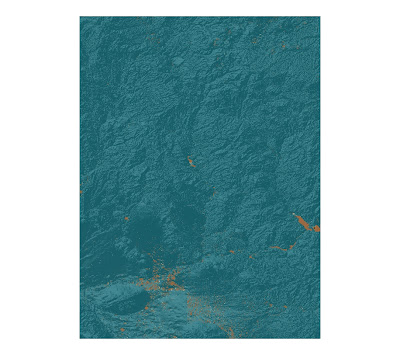
Hillshade map of Grand Canyon, Arizona
Slope Map of Grand Canyon, Arizona
Aspect Map of Grand Canyon, Arizona
3D map of Grand Canyon, Arizona
The area that I have selected for this lab is a part of the Grand Canyon, which is located in Arizona. I selected this portion of the Grand Canyon because it contains a mix of low lying, flat and hilly terrain which can accent the different types of spatial analysis conducted using ArcGIS. Each map contains valuable information about the area- elevation, slope inclination, the direction at which each slope faces and a 3D model of the area. I was very impressed with the ability of GIS to build a 3D model, as it also allows for a futuristic "fly-over"- a first person view of a 3D terrain that is almost like you are there in person.
Extent Information:
Top: 34.7227777768969
Right: -111.091666665802
Bottom: 33.142222221235
Left: -112.274444443659
Spatial Reference:
GCS_North_American_1983


No comments:
Post a Comment